
Mobile data collection and more made easy
GI-ANT
GI-ANT enables secure, loss-free, and efficient data capture and processing in the digital age. Its modular solution combines mobile data collection, cloud storage, and flexible integrations, ensuring that information is available anytime, anywhere, and in real time. Built on open standards and individually configurable workflows, GI-ANT enables seamless data analysis, enrichment, and integration with a wide range of systems.
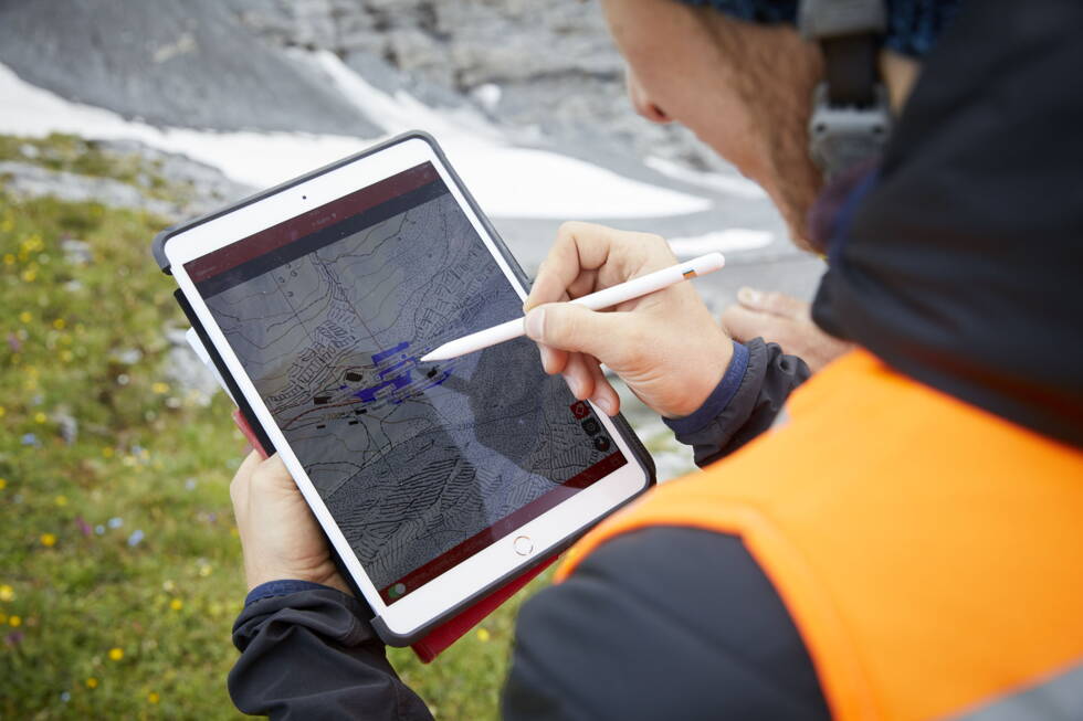
In the age of digitalisation, it is no longer enough simply to collect data digitally. It must also be possible to transfer it securely and without losses so that it can subsequently be used, processed and analysed in downstream systems. GI-ANT offers a practical solution based on individual, connectable components that have been tried and tested in practice for years and are continuously developed by a large user community. The GI-ANT ecosystem includes an app for mobile devices, which enables customised data entry that is optimal for field workers.
The data collected in this way is stored securely in the cloud, independent of the application. This ensures that the data is available at all times with the appropriate login credentials, that it can be synchronised in real time provided there is an internet connection, and therefore that it is accessible regardless of location, time or application.
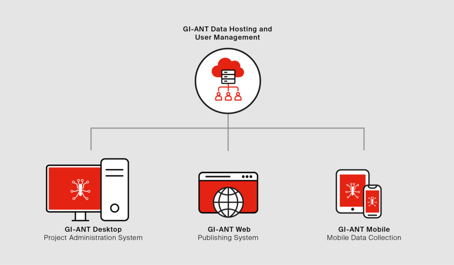
When it comes to field data collection, GI-ANT is not limited to alphanumeric data. Media data, such as photos and voice messages, can also be captured and assigned to the relevant objects. All collected data is spatially and uniquely located depending on the use case.
During the design process of the customised solution, predefined value lists can be created, plausibility checks defined, and other factors taken into account to ensure that data collection is as simple and efficient as possible.
Because the data is managed using open standards, further processing options are unlimited: publication in a dashboard, report generation for experts, or a format-specific export for third-party systems – anything is possible.
Applications of GI-ANT
Monitoring of Protective Measures
GI-ANT enables the condition assessment of natural hazard protection measures carried out in the field to be communicated immediately to the responsible specialists. Colour-coded map features allow maintenance requirements to be quickly identified, precisely located, and prioritised according to urgency. Structures located in steep or difficult-to-access terrain can be documented and assessed in greater detail using linked photographs, plans, and other supporting information, ensuring efficient maintenance planning and a complete digital record.
Hazard Mapping
Location-based field data collection has successfully supported our hazard mapping specialists by allowing preloaded, site-specific datasets—such as land use maps and other information required for damage potential assessments—to be supplemented directly in the field.
Borehole Data Capture
A digital form with standardized terminology simplifies the on-site recording of borehole information. The collected data is then used by our specialists in the office to efficiently generate borehole logs.
Tunnel Condition Assessments
Maintenance requirements identified during tunnel inspections are recorded directly on tunnel plans or digital scans for each tunnel section. This eliminates the need for extensive paper plans and significantly improves the efficiency of tunnel condition assessments. Standardized inspection reports can be generated at the touch of a button, while the system also supports the tracking and management of planned maintenance and repair activities.
Asset Management
The combination of GI-ANT's map interface and building floor plans provides a clear overview of equipment locations, maintenance history, and repair status. GI-ANT also highlights assets requiring maintenance and indicates when the next service interval is due.
Building Condition Assessments
GI-ANT forms the foundation of our GEO.Immobilien building assessment solution. The system enables drill cores collected during building inspections to be accurately located on floor plans and supports the generation of standardized reports on hazardous substances identified within the samples. The integrated map interface also provides property managers with a comprehensive overview of their entire building portfolio.

Feldapp is now GI-ANT.
Developed by us
GEOTEST structures, organises, and manages your data assets.
Modelling of rockfall processes on 2D terrain profiles – providing a sound basis for the planning of mitigation measures.
An overview of GI-ANT’s strengths and advantages:
Efficient collection of spatial and attribute data – independent of location, time and staff – in parallel operation
Immediate analysis capabilities with ongoing synchronisation at a central hub
Use of open-source components to keep costs low
Centralised data management in the cloud for simple, barrier-free access
Seamless integration of (app-based) mobile data collection, GIS (Geographic Information System), and visualisation in a web browser
Data collection forms created to meet specific customer requirements
Export options without format-related restrictions
Unlock the Full Potential of Your Geospatial Data
Looking to capture, manage, analyse, or digitally transform your data?
Get in touch for a no-obligation consultation. Together, we'll develop the right geoinformatics solution for your project.