Calculating risk – better assessment of natural hazards
Such assessments are often crucial for the people affected – both for their everyday safety and for long-term decisions. Knowledge about natural hazards also plays a central role in planning for the future: is it worth investing in a house if the next hundred-year rockfall event could destroy it?
GEOTEST AG has specialised in assessing such risks for decades. Its extensive experience with field-based work and in process dynamics is central to this competency. New technological developments create additional opportunities to better model and monitor natural hazards and to detect them at an early stage.
One such emerging approach is probabilistic hazard assessment. By complementing existing methods, it enables a comprehensive quantitative assessment of the probability of occurrence and the possible severity of an event. This makes it possible to determine not only whether an event will occur, but also how severe it could be – and with what probability.

A comparison between the previous method and the probabilistic evaluation indicates striking differences in the extent of the risk areas.

Probabilistic hazard assessment is another tool used in GEOTEST's day-to-day work.
As part of their annual ‘Journée de formation’, i.e. professional development days for engineering geology, GEOTEST employees exchange experiences and examples of how the probabilistic method can be applied. The approach has been used particularly intensively at Spitze Stei near Kandersteg to analyse the risk of a possible rockslide
Thousands of simulations, each with slightly different assumptions, are required to obtain reliable results. Only with modern computing power is it possible to carry out these analyses within a reasonable time frame.

GEOTEST is conducting a large number of simulations to assess the risk of a rockslide at Spitze Stei and to evaluate the probability of possible scenarios.
GEOTEST is working closely with higher education institutions to exploit the potential of these technologies. New software tools for probabilistic hazard assessment are developed at these institutions, and then GEOTEST tests them in the field and develops them further. This feedback from practical applications is extremely valuable for research.

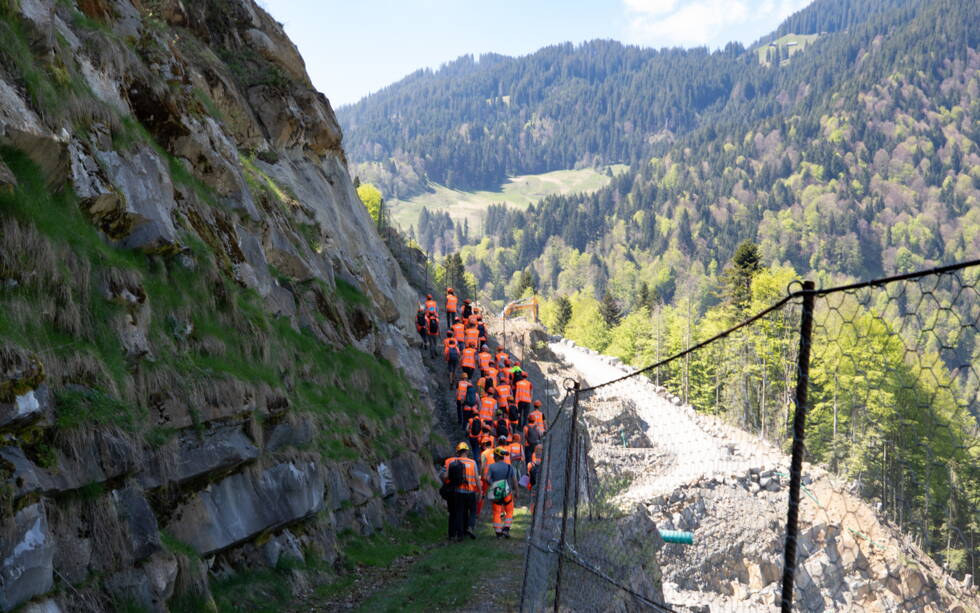
The professional development course took place at the Guber quarry in Alpnach.
During the professional development day, participants also visited the Guber quarry, which borders an area prone to rockfall and landslides. The landscape, characterised by fallen boulders and landslide debris, is an impressive reminder of the importance of a thorough risk assessment.

The risk of rockfall in the vicinity of the Guber quarry has been recognised for a long time.

Boulders in the terrain bear witness to past events.

The steep rock faces illustrate the challenges regarding safety in the quarry.
In the concluding workshop, two key aspects emerged that are crucial for the practical application of the probabilistic method:
Dealing with uncertainty:
uncertainty is inherent in probabilistic methods, too – it is not possible to make exact predictions. Nevertheless, this approach provides a valuable and comprehensible basis for decision-making. It is important that experts are aware of the limitations of the method and communicate the uncertainties transparently.
Communication of results:
even with probabilistic hazard maps, comprehensible explanations are needed for decision-makers, authorities and the public. Only in this way can the meaning of the results be correctly understood and accepted.
Probabilistic hazard assessment is increasingly being used at GEOTEST – not as a replacement, but as a complement to in-depth field expertise. Ultimately, no method can replace the on-site experience of specialists.

The two-day professional development course enables engineering geologists to learn more about probabilistic hazard assessment and to get to know their colleagues better.