Data Management
Since 2024
Spatial Data – Added Value of a Web-Based 3D Software
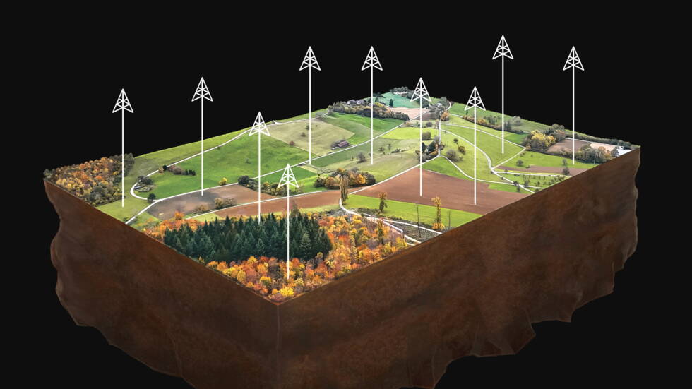
During any major intervention in the subsurface, extensive three-dimensional datasets are collected. Typical examples include drillings, where the stratigraphy as well as the physical and chemical properties of the subsurface are examined. Changes in the terrain surface – such as landslides, quarries or landfills – are also documented and monitored through repeated drone surveys and the resulting surface models.
High Costs, Varying Resolution and Coverage
The collection and processing of spatial data typically involve considerable costs. The resulting datasets often differ significantly in terms of their resolution and spatial coverage: while drillings provide geological information down to the millimetre scale, geophysical prospection methods deliver data covering several square kilometres with a resolution in the metre to tens-of-metres range.

The geological 3D model can be sliced at any point using a dedicated tool. Shown here, as an example, are survey data of a salt cavern at different points in time.
Below: Drag the slider to switch between the map model and the 3D data model.


A geological 3D model developed for Schweizer Salinen AG on the basis of various geoscientific datasets (drilling data, geophysical data, geological mapping). By integrating the model into a 3D viewer, its content can now be used by different user groups.
Challenges in Data Management
Different planning teams use these datasets for various applications – often relying on specialised and costly software. Many project owners lack the ability to centrally view their valuable data in an integrated 3D environment, instead relying on reports and unreviewed files. The consequence? 3D model data often end up merely as an attractive graphic in a report, and the potential of these datasets—especially for discussions within distributed teams or with the client—remains untapped.
Efficient Data Management with the 3D Web Viewer
In this context, GEOTEST AG offers a powerful, field-tested solution: with a web-based 3D software (Giga Infosystems), spatial datasets can be centrally and systematically managed, and then visualized and analyzed in an integrated manner together with the collected exploration data.
In collaboration with Swiss Saltworks Ltd., this system has been successfully implemented. Drilling data, reflection-seismic datasets, surveying data of the salt caverns, and geological structural models are thereby made accessible and analysable for the entire team and for regulatory authorities.
Our continually growing geospatial data holds tremendous potential. With the support of GEOTEST AG, we were able to implement a modern 3D web viewer that enables us to use this data efficiently and comprehensively.
Johannes Pietsch, Head of Geology, Swiss Saltworks Ltd.
The 3D web viewer can serve as a central data platform in the sense of a “single source of truth” and, through the integration of other platforms, enable structured and integrated data management. This is overseen by a data-responsible person to ensure the systematic collection and long-term use of new datasets. At the same time, the integrated data analysis increases added value by making information more widely accessible within the company and to third parties, such as regulatory authorities.


The geological 3D model can be sliced at any point using a dedicated tool. Shown here, as an example, are survey data of a salt cavern at different points in time.
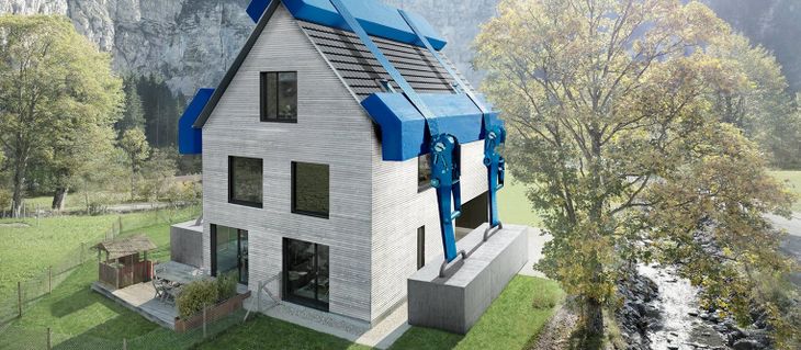
Application in Complex Construction Projects
Also for complex projects the 3D Web Viewer helps to clearly visualise underground structures and their interactions with the changing surface. The integration of diverse datasets can be implemented with manageable effort.
Added Value for Internal and External Stakeholders
In addition to internal benefits, external stakeholders—such as permitting authorities—also profit from access to processed spatial data. For complex projects, this transparency enhances traceability and significantly increases acceptance of the proposed initiatives.
Our Commitment: Unlocking Added Value from Your Data
GEOTEST is convinced that the full potential of spatial data often remains unused—primarily due to inconsistent data storage and a lack of visualisation or analysis tools. With our expertise in 3D data management, we create significant added value for your datasets and future projects.
Would you like to use and showcase your spatial data more efficiently?
Contact us – we bring your data into the third dimension.
Auftraggebende
Among others:
- Schweizer Salinen AG