From a renovation project to comprehensive rock stabilisation
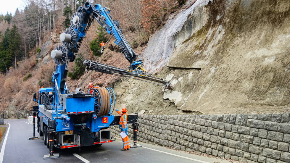
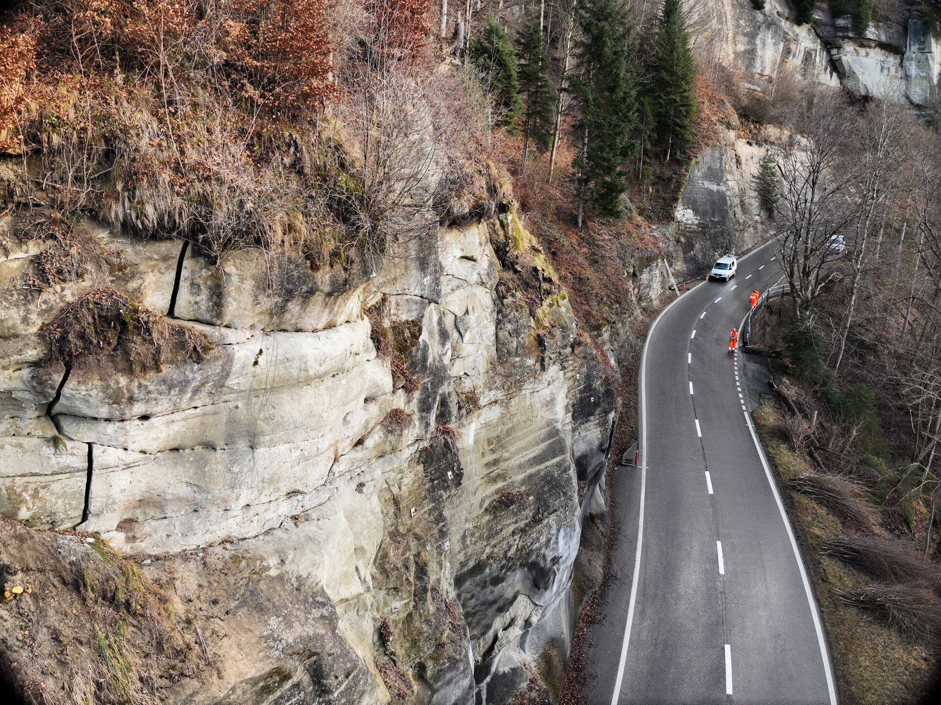
On behalf of the Civil Engineering Office of the Canton of Bern, GEOTEST AG investigated the rock face using drone imagery, as well as through site inspections and work carried out whilst suspended by rope. In the process, the team examined cracks in the rock face — a key indication that individual sections of rock were unstable and posed a safety risk.
The existing rock face stabilisation measures were in need of refurbishment.
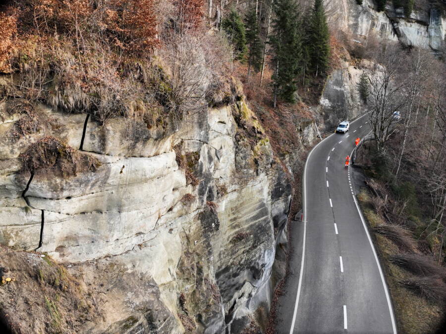
Drone images of the rock face above the road showed cracks in the rock.
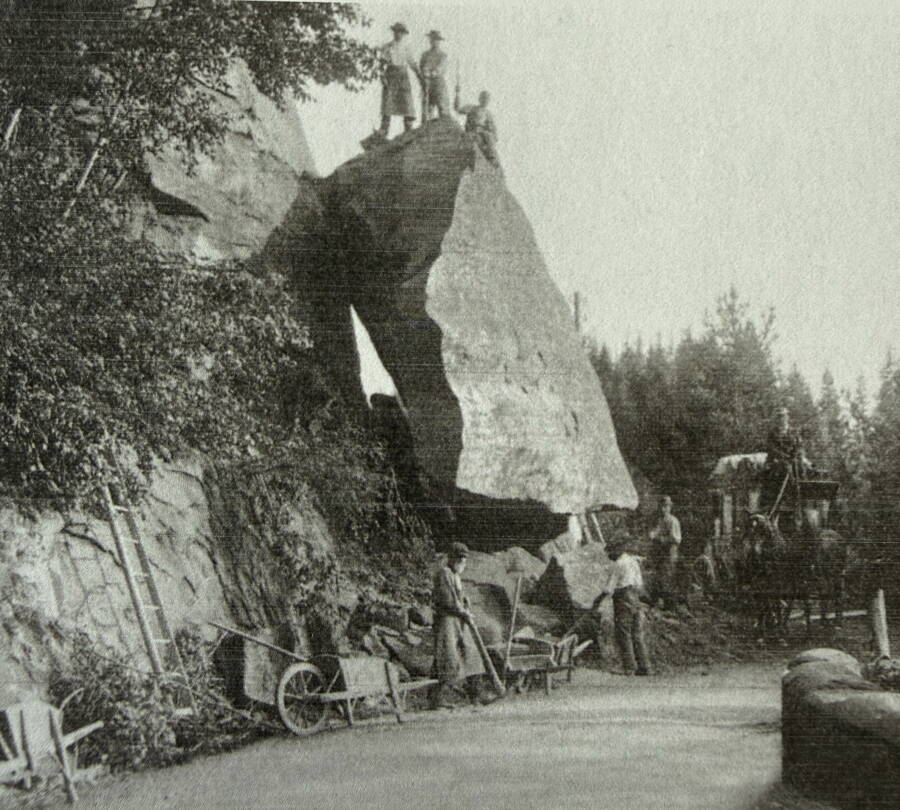
Postcard depicting the rockfall of 1910. Source: Municipality of Schwarzenburg (ed.): 1000 Years of Schwarzenburg, Schwarzenburg 2025, p. 93, fig. 108.
The affected section of road is known for rockfalls and rock slides, as shown by a historical photograph from 1910.
What initially began as the refurbishment of an existing safety measure developed into a comprehensive rock stabilisation project: following a major rockfall within the construction site perimeter, GEOTEST AG carried out a fresh, extensive assessment of the situation.
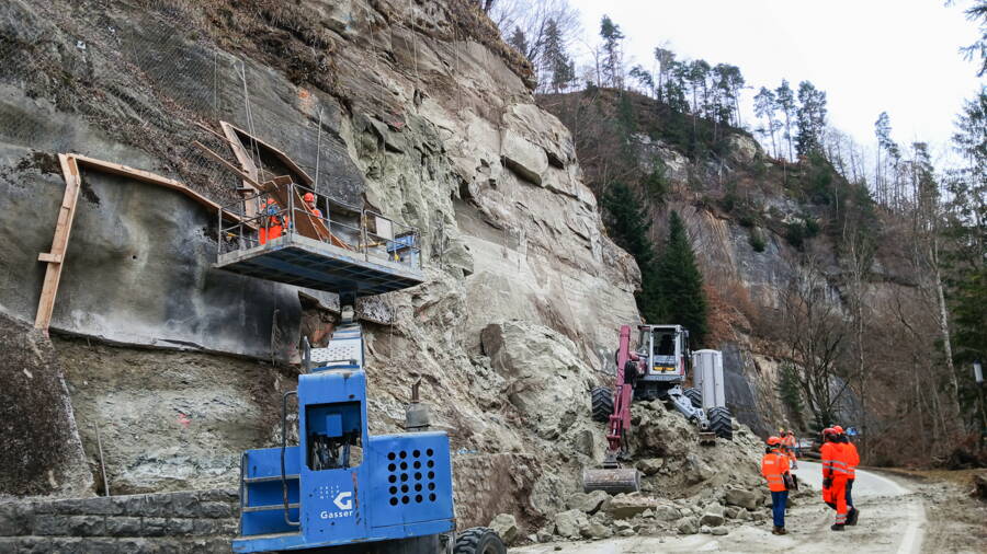
A rockfall occurred not far from the construction site.
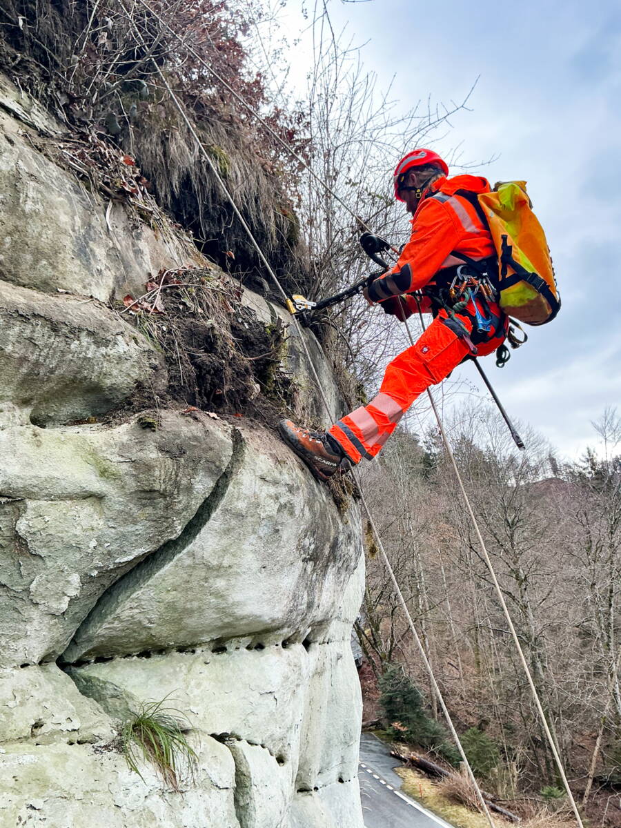
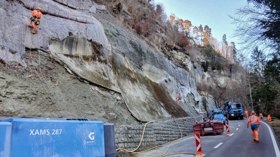
Investigations and work on the suspended cable were necessary.
In addition to rock removal, rock cleaning and shotcrete, further rock stabilisation measures were required. These included protective nets, long anchors in the rock face and several controlled blasting operations to remove unstable sections of rock in a targeted manner. In total, around 500 to 600 cubic metres of material had to be removed, partly by hand. During the construction work, safety was ensured by monitoring points using two Telejointmeters, as well as regular inspections carried out in conjunction with the contractor. The high-precision measuring devices continuously recorded changes in the fissure and rock structure, thus enabling ongoing assessment of the slope.
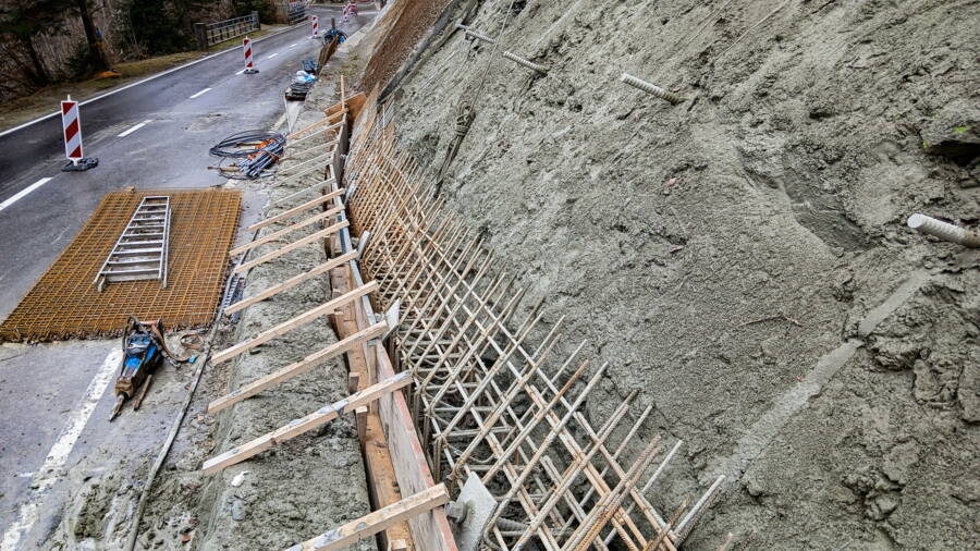
The embankment is being re-stabilised.
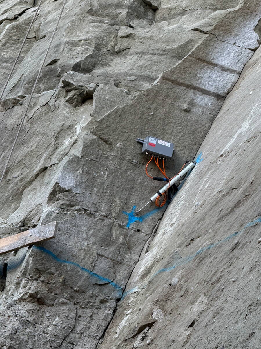
GEOTEST is monitoring rock movements using Telejoint meters along the cracks.
In some areas, GEOTEST has laid Howolis to ensure the long-term stabilisation of the embankment. These erosion control mats protect the surface from washout and support the revegetation of the slope.
The work has now been completed, and Freiburgstrasse has been safely reopened to traffic. GEOTEST’s comprehensive investigations revealed previously hidden weaknesses in the rock face, thereby enabling targeted, sustainable stabilisation measures to be implemented in the affected section. Through the combination of geological assessment, continuous monitoring and technically sophisticated stabilisation measures, the risk of rockfall and rock slides has been significantly reduced.
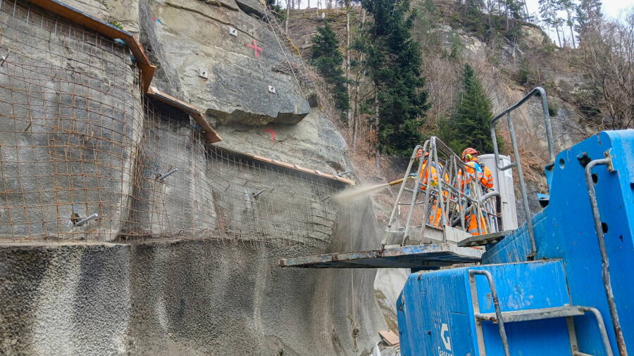
The use of shotcrete is one of the stabilisation measures.
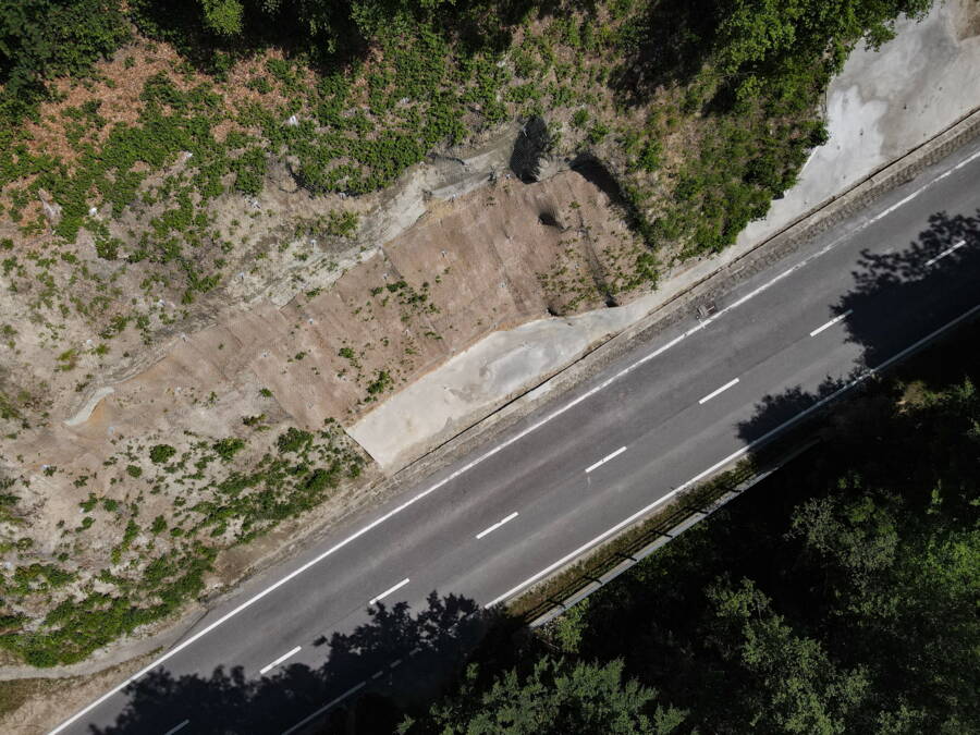
The first plants are growing again in the rehabilitated area.
What was originally planned as a localised rehabilitation project thus evolved into a comprehensive stabilisation project that not only eliminated the immediate hazard but also improves the long-term stability of the entire affected section of the slope. As a result, an important transport route for the region is once again reliably usable – and, at the same time, the affected area is better protected against future natural hazards.