Quick decisions made under pressure: GEOTEST supports safety measures on the A8 Brünigstrasse following a rockfall incident
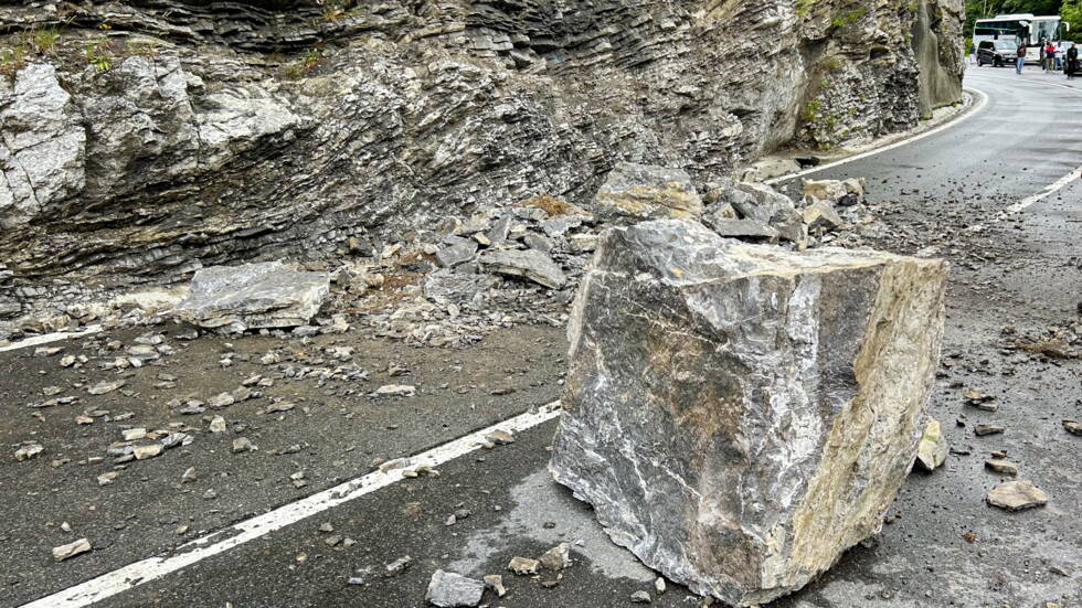
On the day of the incident, swift action was required when boulders and rocks broke away from the rock face and crashed onto the busy A8 Brünigstrasse in the canton of Obwalden. Besides the immediate clearance of the national road, the responsible authority, the Federal Roads Office (ASTRA), was faced with one key question: can the road be reopened quickly – or does an acute danger still exist?
A well-founded initial assessment made under time pressure
ASTRA immediately called in experts from GEOTEST to assess the situation on site. In the rock embankment around the collapse site, they identified fresh cracks and displacements in the rock face – clear indications of new movements within the rock.
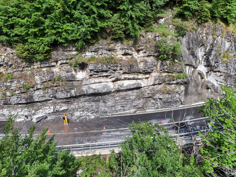
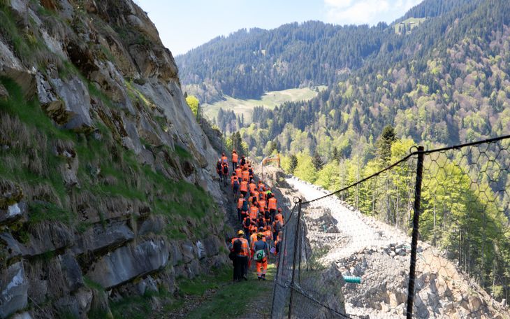
The rock face immediately after the incident, with GEOTEST specialists on site. On the right-hand side, a section that had previously been secured following a rockfall incident is visible.
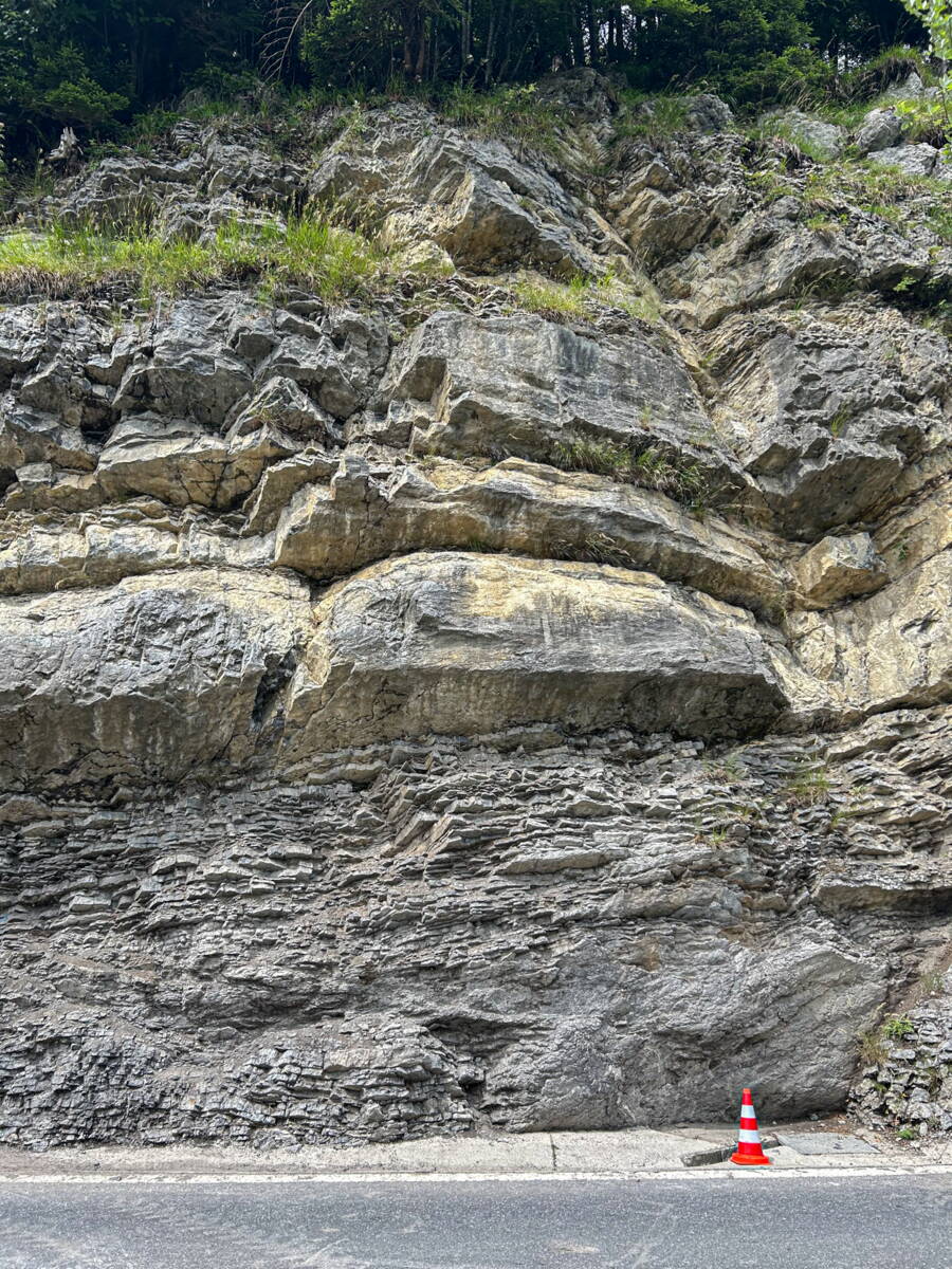
The rock face immediately after the incident, with GEOTEST specialists on site. On the right-hand side, a section that had previously been secured following a rockfall incident is visible.
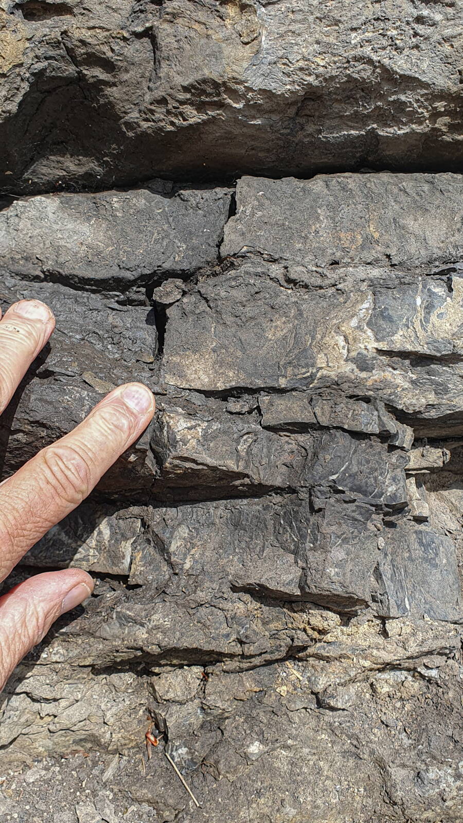
The lower layers are susceptible to weathering, due to the soft marl layers (near the index finger). The image also shows how the centimetre-thin limestone layers fracture vertically under the weight of the overlying rock.
Based on this assessment, GEOTEST developed various incident scenarios that served as the basis for decisions about the next steps.
A decision had to be made quickly as to whether the road could be reopened or whether the risk of further rockfall incidents was too great
– Project Manager Giacomina Bucher
The valley-side lane was subsequently reopened under observation, whilst the mountain-side lane remained closed for safety reasons. In addition, a monitoring system was installed in the rock face, which would enable an immediate closure in the event of further movements.
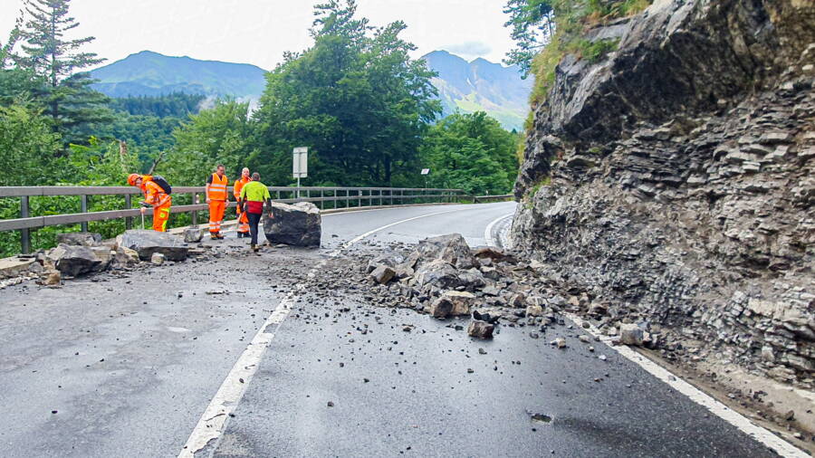
During the rockfall incident, a total of 6 m3 of rock broke away from the face and crashed onto the road.
Geological challenges clearly identified
The detailed analysis showed that the cause of the incident lay deep within the rock structure. Layers of marl susceptible to weathering, as well as unfavourably oriented joint sets, meant that potentially unstable sections of rock extended across the entire road embankment. Fresh cracks indicated that larger rockfall events from the embankment were to be expected in the near future.
These findings were crucial: the risk of further rockfall incidents – including larger boulders that could reach the open carriageway – had to be classified as a real danger.
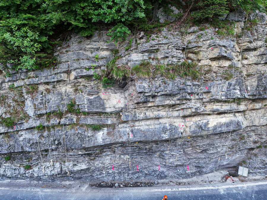
Following the incident, the geologists systematically examined the rock face for further instabilities and potential failure points.
The path to a sustainable, safe solution
Temporary safety measures were not sufficient to restore the road to full two-lane traffic.
In close collaboration with ASTRA and the project stakeholders, various options for immediate measures were examined.
One key constraint was clear: a total closure of this heavily used transport route had to be avoided.
Under these conditions, the complete removal of the unstable rock embankment proved to be the best option. Other solutions, such as anchoring or complex stabilisation structures, would have required significantly more time and space and would have necessitated a longer total closure.
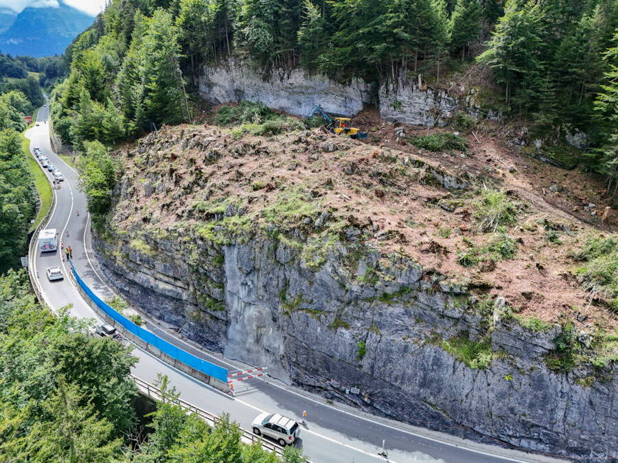
The mountain-side lane was closed to traffic and fitted with an alarm system.
Geological monitoring and modelling
GEOTEST subsequently played a key role in the planning and implementation of the measures. This included:
development of the structural geological parameters for the excavation planning
continuous geological monitoring of the work on site
numerous site inspections and assessments of the situation
advice on safety-related issues
rockfall modelling to determine the dimensions of wall heights and berms
The predictions were confirmed during excavation: the joint structures encountered largely corresponded to those in the models developed beforehand.
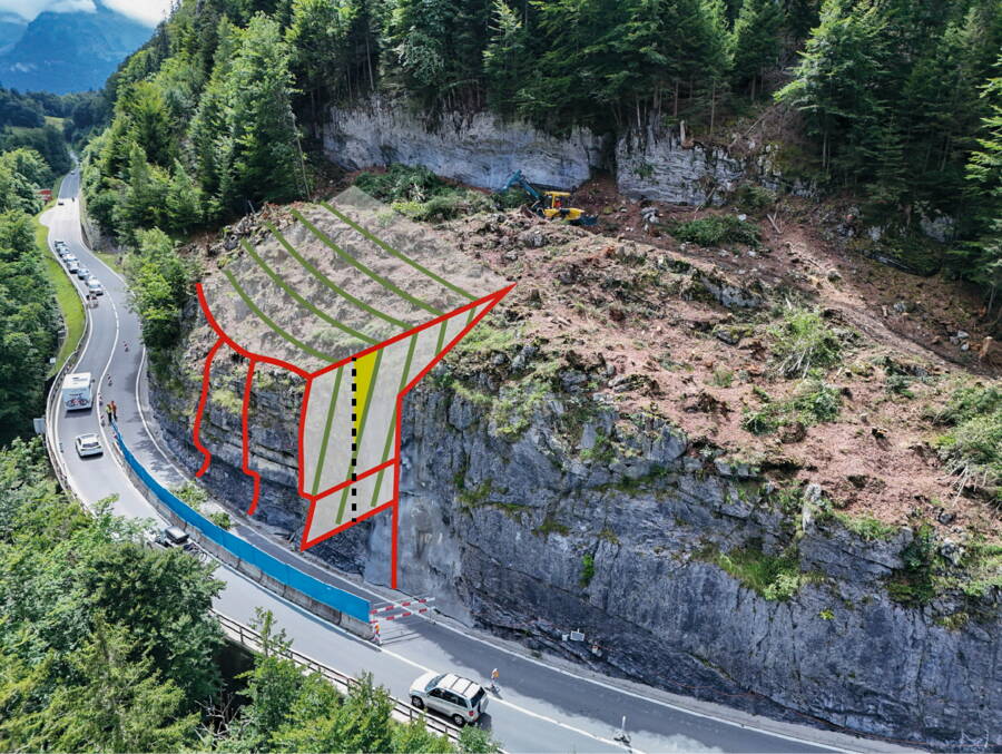
The almost vertical joint structures (green), in combination with the almost horizontal bedding planes (red dotted lines), cause instabilities in the rock face.
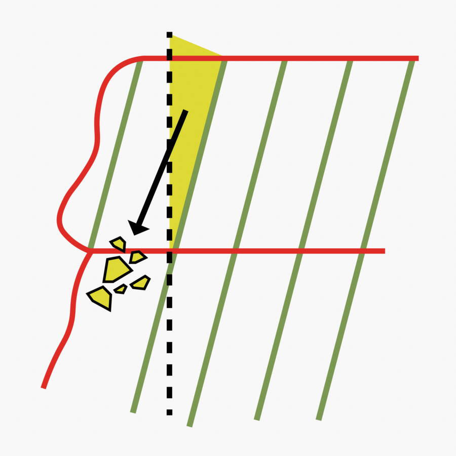
Due to the subvertical joint structures within the rock, simple excavation along the black dotted line would not be effective, as this would encourage rock wedges (yellow) to slide along these joints. Excavation was therefore planned along the green lines to prevent such rock wedges from forming.
Long-term stabilisation of the route
During the work, all unstable material was removed and the embankment was structured using terracing (berms). In addition, rockfall protection catchment fences were installed. Areas of marl particularly susceptible to weathering were targeted and sealed with shotcrete to prevent future weathering processes.
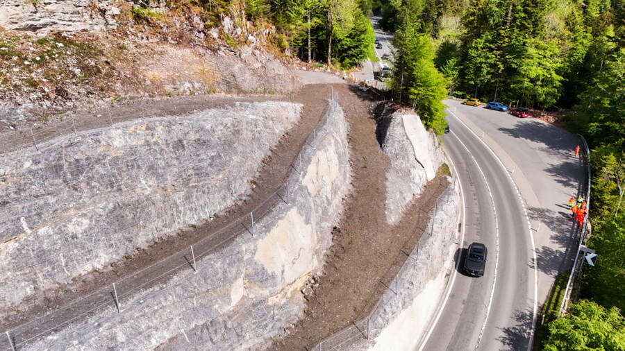
The embankment was terraced...
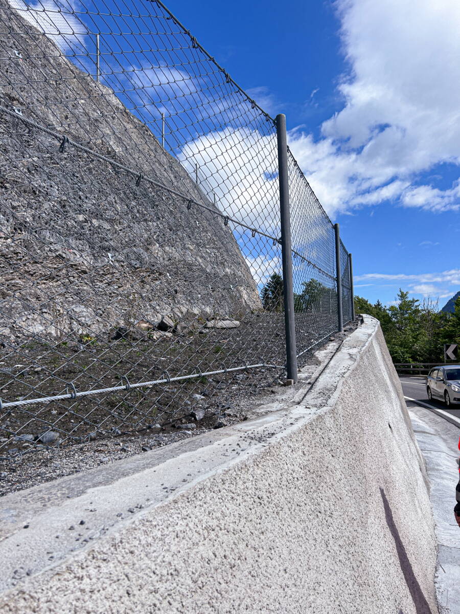
...and secured with protective fences.
Today, the embankment has been replanted and integrated into the landscape. The A8 Brünigstrasse is open to two-lane traffic and has been secured for the long term.
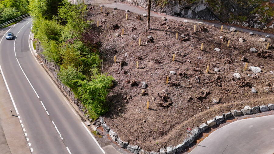
One year later, the vegetation on the embankment is in the early stages of growth.
Lessons for the future
The incident in July 2025, as well as earlier incidents, highlights the importance of regular assessment and rock clearance, as carried out on many road embankments along the Brünigstrasse. At the same time, the incident shows that, despite the systematic implementation of various measures, not all hazards can be eliminated.
The project underlines the importance of swift, well-informed decisions and interdisciplinary collaboration. Within a short space of time, a single incident gave rise to a complex emergency response – with the aim of ensuring both the safety and the availability of this vital transport corridor.
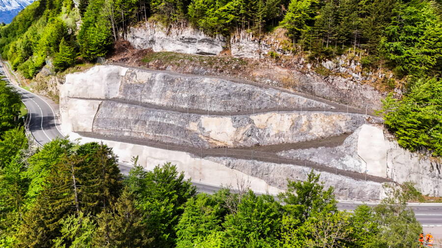
Since December 2025, the Brünigstrasse has once again become fully passable.