Identifying, assessing and mitigating natural hazards
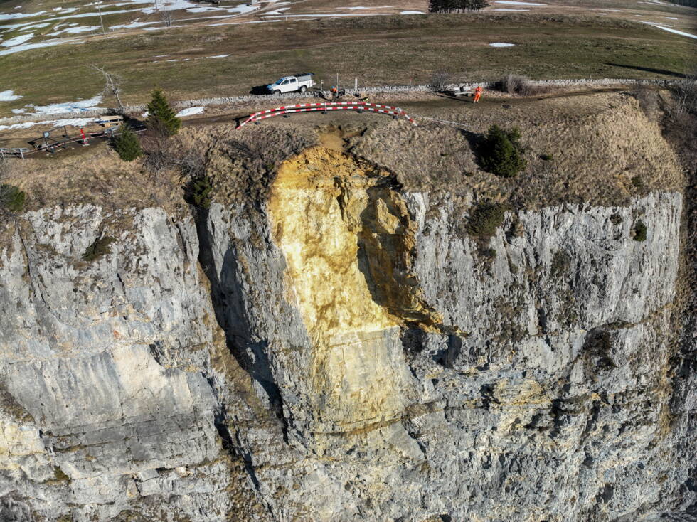
In early January 2026, a large block of rock broke loose at the Wandflue cliffs near Obergrenchenberg and tumbled towards Bettlachberg. The rockfall caused damage to the forest. Initially, it was unclear whether further sections of rock that had become loosened might also break away. The relevant authorities therefore designated a danger zone for safety reasons and closed the footpath between Oberes Brüggli and Bettlachberg.
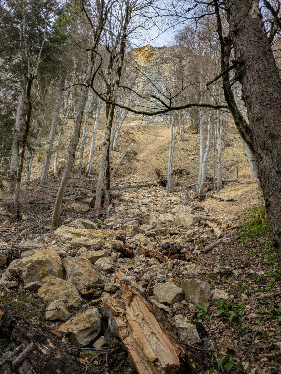
The material that broke away from the rock face amounts to approximately 500–600 m3.
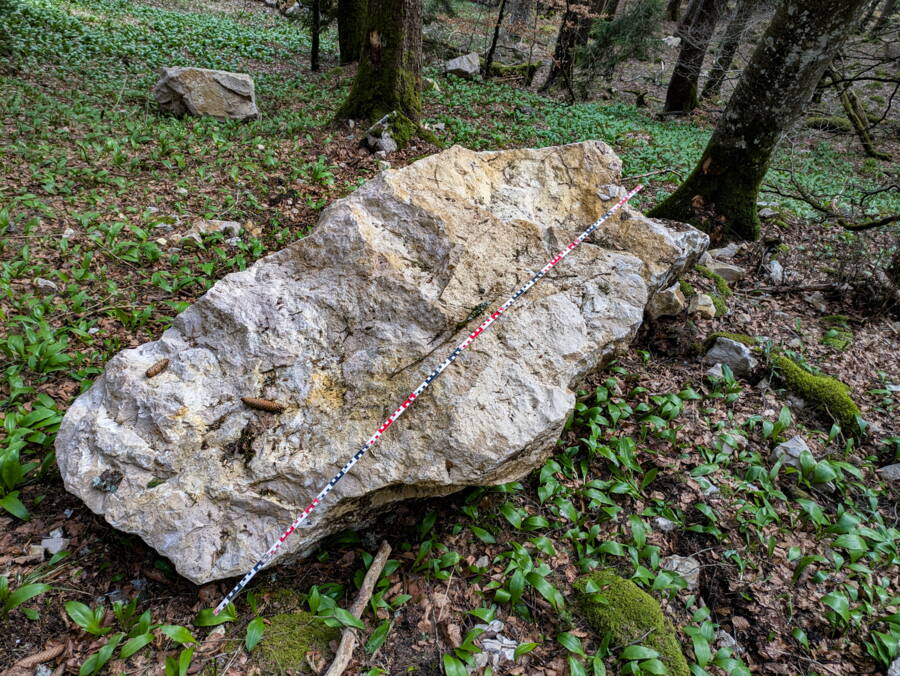
This includes individual boulders with a maximum edge length of just under 3.5 m.
To carry out a detailed assessment, the municipality of Bettlach required geological and engineering-geological evaluations. Experts from GEOTEST analysed the incident, assessed the condition of the fracture site, and developed a basis for further action.
On 13 March 2026, the teams conducted rock clearance and fieldwork under favourable conditions. In doing so, they removed minor instabilities along the fracture line. They also assessed the situation around the fracture site using drones and while suspended on a rope. On the ground, they recorded and mapped the debris of the rockfall.
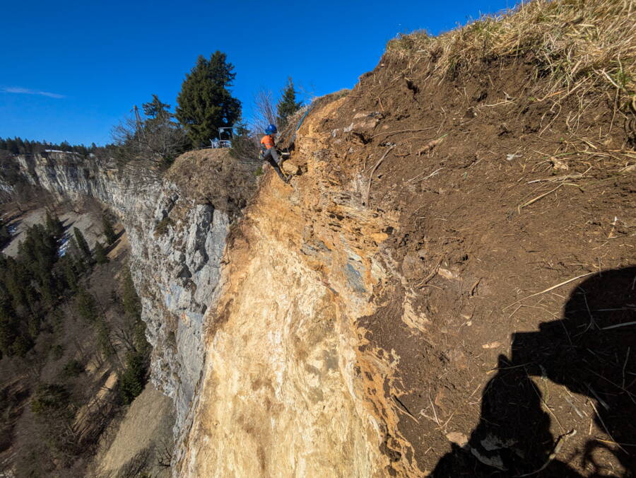
The GEOTEST specialists assessed the stability of the fracture site, including evaluations made while suspended on a rope.
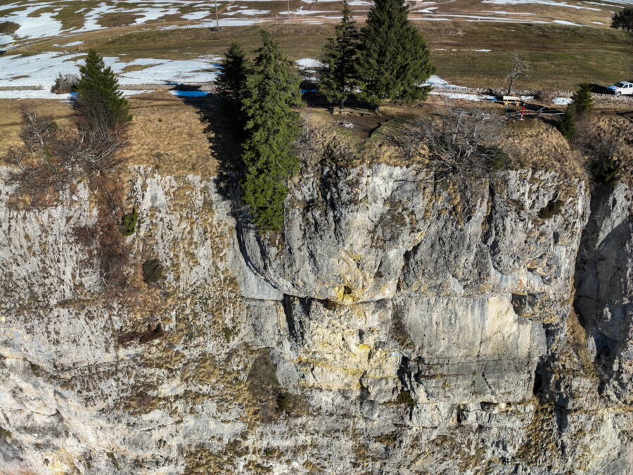
They also checked overhangs at other points along the rock face for potential fractures.
Upon completion of the work, the experts concluded that there was no longer any increased risk to the footpath or the mountain restaurant below the Wandflue cliffs. The relevant authorities subsequently reopened the footpath and lifted the danger zone designation.
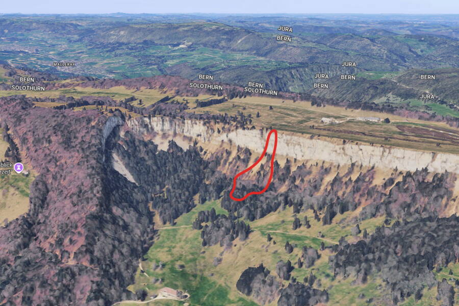
The footpath below the rockfall site (red outline) is not within the debris cone, but it was closed as a precaution.
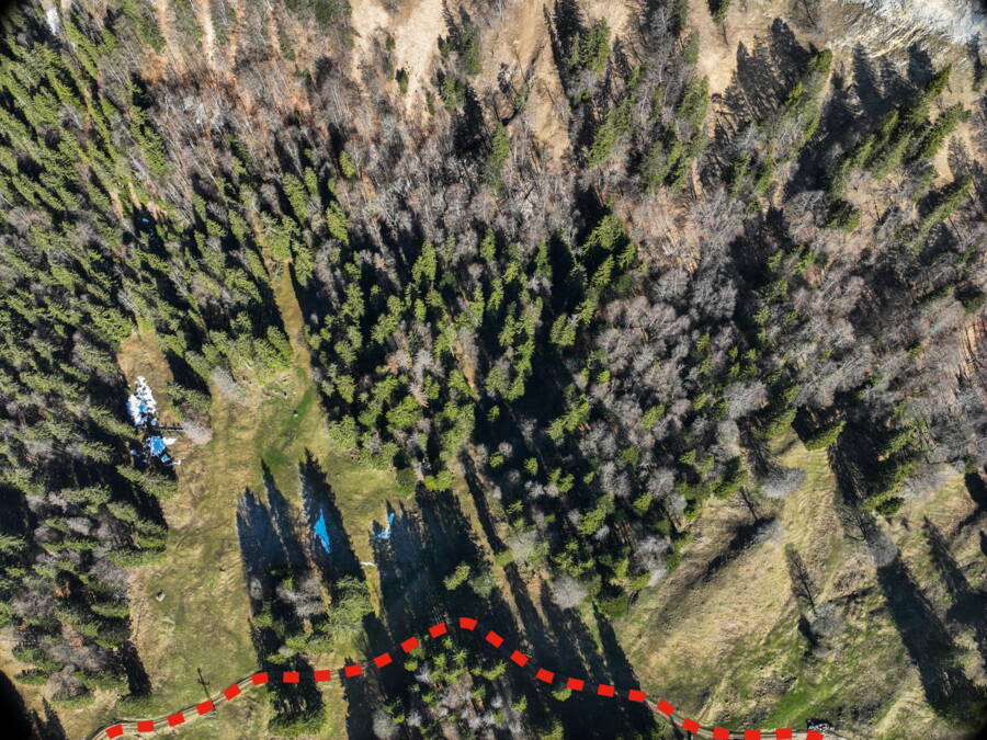
The footpath is now open again.
Natural hazards cannot be prevented. However, they can be identified, assessed and mitigated through appropriate measures. GEOTEST supports local authorities, cantons, government bodies and private clients in professionally assessing such situations, developing a basis for decision-making and implementing solutions to protect people and infrastructure.
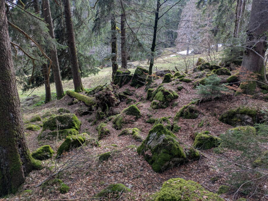
Moss-covered boulders in the forest below the Wandflue cliffs bear witness to similar rockfall events in the past.
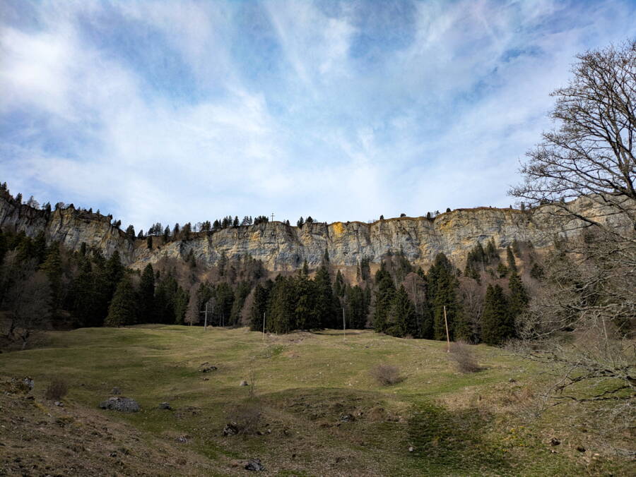
The unweathered, yellowish fracture at the top of the Wandflue cliffs is still clearly visible.